Walking in the Lake District, UK - Great Gable from Seatoller |
An extended walk along to tops of Great Gable, Green Gable, Brandreth and Grey Knotts
| Grade: |
Strenuous |
| Distance: |
14km |
| Altitude Gained: |
900+m |
| Duration: |
5+ hours |
An excellent full-day walk to the summit of one of the Lake District's most famous peaks,
taking in the lesser peaks of Green Gable, Brandreth and Grey Knotts on the return route.
Route-finding is mostly straightforwards, but a compass will help you pick up the correct
tracks from the summits.
|
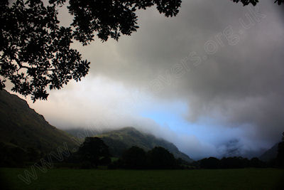
Above: Moody skies at Seathwaite, Borrowdale - September 2012
© Mat & Niki Adlam-Stiles, 201s
|
Walk in brief:
At 899 m high great Gable is undoubtedly one of the Lake District is finest peaks. Many climb great Gable in isolation starting and finishing at the hamlet of Seathwaite. Starting at Seatoller, this circular walk not only gives opportunity to enjoy the valley of Seathwaite
(and the chance to warm up a little before your climb) but also allows for an
extended walk along the summits, with superb far-reaching views accross the Lake
District.
|
|
|
|
|
The start from Seatoller:
The hamlet of Seatoller has a small National trust car park, and is also served by the main bus route from Keswick to Seatoller and from
Keswick to Buttermere. From the car park turn left along the Keswick Road and then almost immediately right along the lane to Seathwaite.
(If you wish to avoid walking along the lane a small detour can be taken by following the path behind the Glaramara activity centre turning
right over Folly Bridge and then following the Allerdale Ramble along black sike to Seathwaite, adding ~1km to the walk.)
Passing between the farm buildings at Seathwaite an obvious path heads South into the fells. Follow the track keeping the river on your right
hand side. After just over a kilometre you reach Stockley Bridge. Cross the bridge and take the steeply ascending path up Styhead Gill and to Styhead Tarn.
|
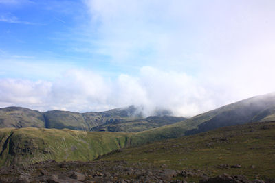
Above: Looking towards Glaramara from Brandreth, September 2012
© Mat & Niki Adlam-Stiles, 2012
|
|
Passing Styhead Tarn on your left you reach an obvious junction with a mountain rescue point. (It is worthy of note that the public
footpath marked on the ordnance survey map (2002) is out of register with the actual paths. ) From the mountain rescue point turn
right (North West) along a paved path. This track forks almost immediately. Left here will ascend Great Gable via Napes needle and
Great Napes. We take the right hand fork to make the direct ascent to the summit of Great Gable.
|
From Great Gable to Honister Hause:
From the summit you are well advised to take a bearing to ensure you pick up the correct path. Our path heads roughly north-east along
a line of cairns at first, dropping to the col at Windy Gap. Straight across at the col climbs to the smaller summit of Green Gable.
Here the path forks again. The obvious right-hand track drops down to Seathwaite. Our route takes the less well trodden left-hand fork
heading north to the tarns at Gillercomb Head and then to the summit of Brandreth.
At the summit of Brandreth the path forks again and taking a bearing may be advisable. The clearer of the two paths heads roughly
north-west towards Fleetwith Pike and Haystacks. We require the right-hand track heading north-north-east to the small summit of Grey Knotts.
From here you are rewarded with superb views to Crummock Water and Buttermere, to Derwent Water, and over the Borrowdale fells.
|
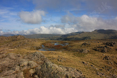
The Tarns at Gillercomb Head -September 2012.
© Mat & Niki Adlam-Stiles, 2012
|
|
Return via Honister Hause
Heading north-north-east descend to the slate works at Honister Hause. From here turn right down the Honister pass. A short distance
along the road and the old Honister Road can be picked up on the left-hand side. This track allows you to descend the Honister pass keeping
largely off of the road. Some way down the pass the track heads left away from the road slightly. A short distance further on a junction is
met, and the path on the right drops you back down to the hamlet of Seatoller.
|
|
|
|